Location Intelligence helps businesses turn geographic data into valuable insights. With this technology, companies can find out where their customers are, how people use physical spaces, and where to expand their operations. At LocationsCloud, we help businesses use Spatial Data to make better decisions every day!
What Is Location Intelligence?
Location Intelligence merges Geographic and Business Data to uncover trends and opportunities based on Market Goals. Such as “Where would be the best place to open our next location?” or “Where do our ideal customers reside within the city?”
LI pulls Geographic Data from multiple sources, including GPS coordinates, Addresses, Satellite Images, and Demographics (all of which are then analyzed through specialized Mapping Maps). It allows companies to gain insights into how to maximize their Operations, predict outcomes, and improve their Performance.
Market research states that 80% of all business information has a location component, yet most companies do not fully leverage that resource. LI fills this gap by enabling companies to access and utilize the vast resources of Limited Geographical Insights.
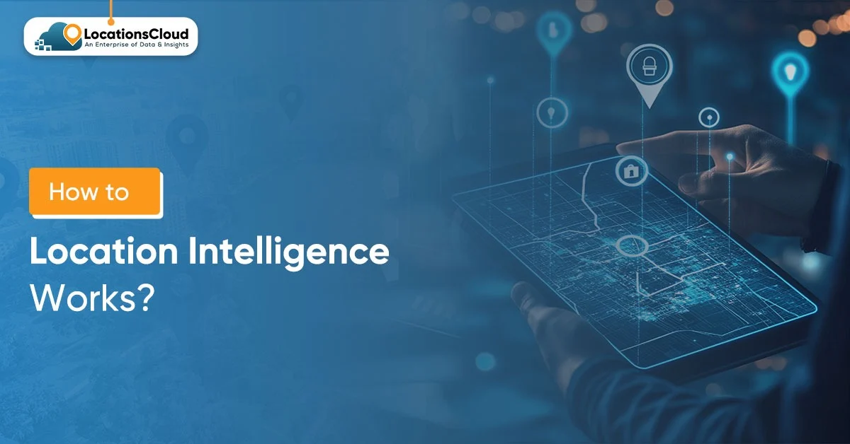
How Does Location Intelligence Work?
Location intelligence is a process that uses a series of steps to interpret data and present it visually, providing businesses with valuable insights. To utilize location-based software solutions, you need to understand them thoroughly.
Data Collection and Integration
The system will start taking data about your location. It includes where your customers live, where their transactions occurred, signals from their mobile devices, where their IoT devices are located, and where people are, based on census data. The LocationsCloud combines data from all sources into a centralized location.
The data will be collected in three phases: the collection of Spatial Data (GIS coordinates and limits); the collection of Attribute Data (location attributes); and the collection of Temporal Data (event dates/times). The combinations of these three factors will provide a full view of the regional data patterns.
Geocoding and Address Standardization
The next step in the process is geocoding, which converts a postal address to its corresponding geographic location (latitude and longitude). For example, the address “123 Main St., Boston, MA” would be converted to the proper latitude and longitude for that location.
To ensure uniformity in datasets, standardisation provides a consistent way to reference locations across datasets. For instance, “Street” will be referred to as “St,” and “Apartment 5B” as “Apt 5B.” This standardisation process lets LocationsCloud match its records accurately and minimize potential duplicate records, which may affect its data analysis.
Spatial Analysis and Pattern Recognition
Geospatial analysis supports the identification of relationships between physical areas by creating distance measurements, detecting clusters, and uncovering patterns of correlation that are not readily apparent in traditional tabular data, such as spreadsheets.
Some standard techniques for performing spatial analyses include proximity analysis (searching for locations within a specified distance of a target), heat mapping (visualizing density patterns), and route optimization (computing the most efficient route between two places). All of these analyses will generate insights regarding areas of customer concentration or underserved markets.
Data Visualization and Mapping
The last stage of the process is to take the information/evidence collected during analysis and turn it into interactive maps and dashboards. Visual representations of data enable decision-makers to identify complex geographic patterns quickly.
LocationsCloud enables users to create layer-based maps that display multiple data types simultaneously. Users can display demographic overlays, sales territories, competitors’ locations, and traffic patterns by switching the map layers. Teams will therefore be able to run “What If?” scenarios and test strategies before putting them into practice.
What Are the Key Components of Location Intelligence?
A location-based intelligence system is composed of numerous systems that function together, each requiring support from additional systems to provide input data that produces spatial intelligence about locations.
Geographic Information Systems (GIS)
The backbone of location intelligence is GIS software, which collects, analyzes, and visualizes geospatial information on a digital map. Today’s GIS applications allow users to work with enormous numbers of data points (many billions at a typical GIS company) and perform advanced calculations in a matter of seconds.
LocationsCloud is an enterprise-level GIS system that facilitates the processing of large volumes of data quickly and efficiently. In addition to vector datasets (points, line segments, and polygons), LocationsCloud also offers raster datasets, such as satellite imagery, digital terrain models, and other types of imagery.
Spatial Databases
Geographic data is stored in specialized databases that have built-in capabilities for performing spatial queries. In contrast to conventional databases, spatial databases can answer queries such as “What stores are located within a five-mile radius of this zip code?” and “How long would it take to drive from here to the nearest distribution center?” (i.e., where will my customers be located).
Spatial databases utilize spatial indexing techniques to locate location-based data and return results within minutes. As a result, applications built on such systems can quickly respond to geographic requests in real time, regardless of the size of their underlying datasets.
Mapping APIs and Geocoding Services
Using application programming interfaces (APIs), location intelligence platforms are linked to external mapping systems. The features provided by these APIs include geocoding, routing, elevation, and base map images.
LocationsCloud integrates with the leading mapping providers worldwide, so any inaccuracies are removed. LocationsCloud also utilises a live connection, so any new road networks and points of interest will be available in the Location Cloud database as they are published.
Analytics and Machine Learning Engines
Identifying and predicting future trends through analysis can be accomplished with an advanced analytics engine. With the help of machine learning, forecasting future demand by segmenting geographic areas or detecting anomalies in spatial data can be performed.
For instance, a predictive model uses demographic changes and past sales data to help determine which neighbourhoods are likely to create increased demand for a particular product. Clustering algorithms help group similar geographic areas to target marketing campaigns.
Why Do Businesses Need Location Intelligence?
Businesses and organizations use location intelligence to overcome significant challenges and better capitalize on opportunities. The increase in return on investment from enhanced business decisions can measure the advantages of location intelligence.
Optimize Site Selection and Expansion
Retail, restaurant, and service businesses can leverage location intelligence when selecting new sites. Location Intelligence enables companies to build a model of potential site performance before a lease is signed and to compare several candidate locations side-by-side to identify the site with the highest likelihood of success. Research shows that a data-driven approach to site selection can reduce failure rates by as much as 70% compared to an intuitive decision-making approach.
Enhance Marketing and Customer Targeting
Hyper-targeted marketing programs are made possible by location data. Businesses can target specific neighbourhoods with high concentrations of their ideal customer profile and adjust their advertising budgets to accommodate those neighbourhoods’ needs.
Geofencing technology lets businesses send promotional offers to customers once they’ve entered a pre-defined location. Location analytics data shows which marketing strategies are actually driving customer visits to your store. As a result, the attribution allows you to allocate your marketing budgets more effectively throughout the various channels.
Improve Supply Chain and Logistics
Location Intelligence provides many advantages to distribution networks. Companies can use location intelligence to locate their warehouses in the best locations to achieve the shortest shipping distance and the quickest delivery time. Route planning algorithms help determine routes that accomplish the same goal of reducing fuel costs and increasing delivery efficiency.
LocationsCloud enables businesses to view their entire supply chain geography. It allows firms to identify supply chain bottlenecks, assess the risk of disruption from natural disasters or political instability, and develop contingency plans for disruptions.
Understand Customer Behavior and Movement
Analysis of foot traffic flow enables businesses to frame their plans to create an effective consumer journey, optimise sales potential, and utilise labour management for optimal coverage.
Shopping centres use information gathered through Foot Traffic Analysis to select where to place individual stores within the centre, the geographic location of each selected store, and where to locate each tenant or leaseholder in the centre.
Similarly, care planners (such as city governments) will analyse foot traffic, develop walkable areas, create public transportation options, and better understand pedestrian paths to make their cities more accessible.
How Can Different Industries Use Location Intelligence?
Location Intelligence Applications vary by industry, though some core principles apply across all sectors. Each of these industries has leveraged geographic insight in different ways.
Retail and E-Commerce
Retailers assess their trade areas to determine where they can sell and where their customers come from, and identify gaps in coverage or opportunities for expansion, as well as optimise the location of E-commerce companies’ Fulfilment Centres for delivery speed and cost.
LocationsCloud provides analysis of the cannibalisation impact of new store openings on existing locations, as well as competitive intelligence, including competitor location maps and market share.
Real Estate and Property Management
Real estate professionals rely on location intelligence to determine property values, perform investment analysis, and develop development plans.
Technologies that provide this type of location intelligence draw on data from multiple sources to incorporate factors such as school quality, crime rates, and transportation access, as well as other neighbourhood trends.
Property managers can optimally schedule and respond to emergencies based on maintenance route analysis and tenant evaluations of their demographics. With better property offerings and amenities, landlords can expect to have higher rental prices and occupancy rates.
Healthcare and Hospital Systems
By utilizing Location Intelligence, healthcare organizations can identify underserved populations and determine new service locations based on factors such as disease prevalence, insurance coverage, transportation accessibility between the underserved population and the closest facility(s) for care, and existing provider capacity.
LocationsCloud enables healthcare systems to optimize ambulance routing and support emergency response. In addition, it helps organizations respond to pandemics by identifying infection clusters, resource availability, and other related data.
Financial Services and Banking
Banks consider where to locate branches and ATMs, and what demographic information is available for those locations. They assist banks in determining potential markets and associated credit risks by geographic location.
Insurance companies use location intelligence for underwriting and to better manage claims.
Fraud detection systems utilize this same information to help detect fraudulent transactions. For example, if there are multiple transactions on the same card within a short period of time, from different locations, this will trigger an alert regarding potential fraud.
Investment firms will examine their real estate portfolio across the various locations in which they are invested, as well as trends within those geographic areas.
What Are the Best Practices for Implementing Location Intelligence?
It takes time and attention to develop a successful location intelligence implementation process with a strong focus on data quality. By following these standard practices, organizations can ensure they gain the maximum benefit from their location intelligence initiatives.
Start with Clean, Accurate Data
The strength of location intelligence lies in the quality of the data that drives it. Companies need to invest in data quality before investing in advanced analytics, such as geolocation services. It includes standardizing their address formats, removing duplicate records from their databases, and verifying the validity of their latitude/longitude coordinate points.
LocationsCloud has developed data cleansing solutions that automatically identify and fix the most common data entry errors, such as incomplete address entries, invalid coordinate values (e.g., latitude/longitude), and mismatched records. Conducting regular audits of your data enables you to continue delivering high-quality results as your data evolves.
Define Clear Business Objectives
Organizations need to determine which specific questions they want location intelligence to address. Goals such as “to better understand our customers” can easily transition to objectives like “identify the top 10 zip codes for potential new store locations that best match our demographics, while having no current competitors.”
Establishing clear objectives before commencing data collection will not only help determine how to analyse the data but also measure the success of those analyses. Clear goals will also help guide organisations toward making informed decisions about where and how much to invest in location intelligence capability, along with the business return that can be achieved from these investments.
Integrate Location Intelligence Across Departments
When multiple departments work together and leverage location intelligence to optimize their business operations, they can deliver the most significant benefit to their organisation. A common benefit shared by the Marketing Department, Operations, Finance, and Real Estate teams is that they all receive the same geographic insights and data from the LocationIntelligence.org platform (www.LocationIntelligence.org).
The system provides role-based access and customised dashboards with different views for various departments in the organisation. For example, the sales team will primarily use the application for territory management, while executive leadership will use it to monitor their company’s market expansion efforts; however, all departments access the same underlying data and information from the same source.
Combine Location Data with Other Business Intelligence
When integrated with other Business Intelligence Systems, Location Intelligence can become quite powerful. The combination of Geographic Analysis with CRM data, Financial Systems, and Operational Databases provides a ‘full view’ of Business Performance.
One example of this is the use of Sales Data and Location Intelligence; by combining these, we can determine which regions exceed their targets and the reasons for doing so. Is it the sheer size of the prosperous region(s) that allows them to exceed targets, or is it the better fit of the population in that particular area? When using integrated analysis, we can create much more sophisticated strategies than either Location Intelligence or Business Intelligence could provide on their own.
Invest in Training and Change Management
To benefit from emerging technologies, developing related skills is essential. Organizations need to train employees in basic location intelligence concepts, technology, and practices, whether the individual is an analyst (technical training) or a decision-maker (strategic training).
LocationsCloud provides a full suite of training options that support onboarding and continued education. Users learn to create maps, conduct spatial analysis, and interpret the output accurately. Additionally, LocationsCloud’s user-friendly interface enables non-technical users to become productive quickly.
How Is Location Intelligence Evolving?
As new technology continues to evolve, so does the field of location data and our use of that information in our society. The trends in how organizations use that information are changing.
Real-Time Location Analytics
The use of location Intelligence traditionally focused on historical data and periodic updates. With the advent of modern methods for processing the live nature of location data generated by mobile phone users, Internet of Things (IoT) devices, and connected vehicles, organisations have the ability to respond to ongoing changes in real time.
For example, grocery retailers can adjust their workforce levels based on the current number of customers in-store rather than relying on static averages from historical data. Likewise, logistics firms can re-route their drivers away from accidents or congested areas as they occur.
Artificial Intelligence and Predictive Modeling
Because humans often miss location tracking services, machine learning algorithms are a powerful way to identify complex patterns in location data. Predictive modelling allows us to forecast future conditions from both historical trends and the influence of external factors, such as seasonality.
Using AI-enhanced recommendations, LocationsCloud can identify high-potential locations, vulnerable markets, and anticipated customer behaviour. These predictive models evolve and improve as they gain additional experience predicting and receive feedback on prediction performance with greater amounts of data processed.
Indoor Location Intelligence
The use of maps for outdoor applications is well established and advanced, but the development of indoor location intelligence technology is growing rapidly. Companies are looking to monitor people’s movement within their commercial buildings, such as shopping malls, office buildings, or airports.
Some examples of technologies used to determine indoor location include Wi-Fi triangulation, Bluetooth beacons, and ultra-wideband (UWB) technology. The result is remarkably accurate positioning within an indoor space. The detailed data gathered on how customers move through the space and interact with items will allow companies to use the area more effectively and provide their customers with a better overall experience.
Conclusion
Businesses gain insight into where to expand into new markets, how to optimize operations, and which customers to target. Location Intelligence enables businesses to better understand markets and competitors through the use of Geospatial Data & Advanced Analytics. LocationsCloud’s technology empowers businesses by combining all three components above to maximize the potential of Location Intelligence. Whether you are a Retailer selecting sites, Logistics Companies optimizing routes, or Healthcare Systems serving their communities, the use of Geographic Data will improve your decision-making process.