Today, companies don’t just guess when making crucial business decisions. They use geolocation data from B2B operations to gain advantages and manage resources better. Location intelligence has changed from simple maps to a powerful tool that helps organizations plan for growth and manage risks.
Businesses today utilize location intelligence for B2B market analytics and to make data-driven business decisions across all departments. A marketing team can identify new markets. The sales department optimizes territories. The compliance department evaluates geographic risks. All use the same underlying resource: accurate, location-based data validated by location.
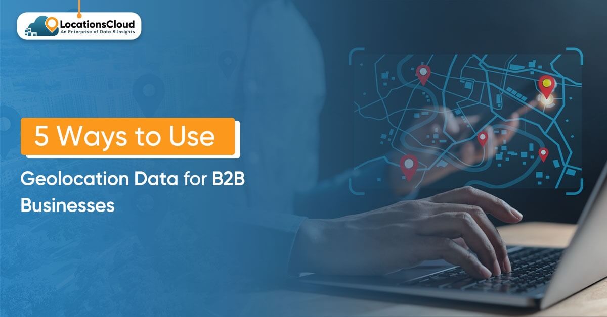
This blog explores five practical geolocation data use cases that deliver tangible business value. We will also discuss how companies have used geolocation data (raw data) to generate valuable insights for their bottom line. We will help you leverage the power of location data analytics by exploring five ways to use geolocation data to enhance your business. If you’re considering expanding your market or creating location-aware applications, these examples of using geolocation data to grow your business can help you maximize your opportunity for success.
What Is Geolocation Data?
Geolocation data for B2B is information used to locate places, things, or activities. It contains both geographic coordinates (latitude and longitude), addresses, points of interest (POIs), and context-specific characteristics, such as business type, hours of operation, and contact information.
While consumer-facing location-based services are often used to help navigate, enterprise-level location data serves as the basis for business intelligence. Enterprise location data helps enterprises analyze spatial trends, aggregate geolocation data by location to better understand market-specific issues, and support data-driven decisions about where to take action.
Examples of enterprise-level geolocation data that you can find in POIs include:
- Coordinate Accuracy: Providing a precise latitude & longitude to position an entity accurately.
- Address Validation: Providing a comprehensive set of standard, verified physical addresses.
- POI Attributes: Business type, category, and operational information about the business.
- Contextual Metadata: Information about business-related elements in the area around the business, including details about standard facilities nearby, demographics of the area, and infrastructure in the area.
LocationsCloud is the best source of validated POI data for businesses, offering accuracy, completeness, and freshness. Companies can rely on this information to make crucial decisions that drive their overall success.
Market Expansion & Site Selection
How B2B Teams Use Geolocation Data for Expansion
Expanding a business into new markets can be one of the most critical decisions a company makes. The potential for financial devastation and wasted resources is high if an improper location has been selected. In fact, B2B location intelligence enables businesses to shift this process from guessing based on intuition to developing a strategy grounded in data.
Companies use geolocation data use cases to find promising areas for investment. They analyze the number of competitors in each location, the number of potential customers, and market saturation. They also examine demographic information such as age, income, and population density.
Furthermore, they assess local infrastructure, such as roads and retail spaces, along with economic indicators, such as housing starts and unemployment rates, to identify business expansion opportunities.
From a retail perspective, leveraging POI data for businesses determines potential store locations by first mapping competitor locations and foot traffic patterns. Additionally, franchise companies can analyze specific metric data, such as sales performance by region, to determine the best areas for future growth/business expansion.
Real-World Application
When it comes to expanding a chain of specialty coffee shops nationwide, this company has done its homework. With help from enterprise location data from LocationsCloud, they can not only identify existing coffee store locations but also analyze population density to find neighborhoods that are good for their new stores, based on household income levels and other demographic data.
Many B2B service providers use the same concept to avoid opening additional branches in overly saturated cities/regions and instead focus their expansion on underserved markets with a significant number of businesses but little or no competition from other service providers.
Business Impact of Data-Driven Site Selection
Expansion risk is significantly mitigated through the use of location data analytics. Rather than relying on anecdotal evidence and/or limited market research, decisions are based on complete data analysis.
As a result of the data-driven approach to decision-making regarding location, companies can:
- Get to market more quickly – decisions made based on data generate data-driven insights, which lead to faster decision-making
- Have a higher success rate – sites selected based on data analysis have historically performed better than those that were not
- Make investments more efficiently – companies place their resources into markets that have a proven ability to support the businesses of companies, and
- Establish a competitive advantage – first mover advantage in opportunity zones.
Competitive Intelligence & Market Mapping
How Businesses Track Competitive Landscape
Knowing where your competitors are located gives you an advantage in a crowded market. Finding this information on your own can take a lot of time and may not be complete. Instead, you can quickly gather it using geolocation data for B2B (business-to-business) purposes to automate the collection of competitive information.
Many businesses create maps of their top competitors’ locations to analyze their reach and identify market gaps. By looking at how competitors expand over time, they can spot key opportunities and weaknesses. This analysis helps companies formulate defensive strategies in their primary markets and develop an offensive approach to enter new markets.
Many SaaS (software as a service) and professional services companies use B2B location data to compare their business locations with competitors. These tools allow users to see where their competitors’ offices and service areas are. Tracking new competitors also helps businesses recognize promising new markets early.
Practical Example: Mapping Market Opportunities
Logistics firms leverage LocationsCloud’s POI data for businesses to depict the proximity of their competitors’ warehouses and distribution centres in major metropolitan areas. From the data analysis, it becomes clear that competitors tend to be concentrated in developed industrial zones and avoid newer suburban logistics parks near new residential developments.
With this insight, the company can strategically secure facilities in these underserved areas. As a result, they can gain preferential access to growing markets before their competitors have even noticed. Additionally, this allows them to build relationships with important customers in these regions ahead of their competition.
Strategic Advantages of Competitive Mapping
Empowering a location intelligence strategy through competitive intelligence provides businesses with several competitive advantages:
Clear Visibility: Gives you a complete picture of how your competitors are positioned in all different markets.
White Space Identification: Helps identify untapped markets with growth potential.
Strategic Positioning – Allows you to make better strategic decisions on where to compete in the future.
Threat Assessment: Allows you to track and measure your competitors’ expansion, enabling you to respond accordingly.
Market Mapping also provides companies with direction for partnership opportunities. Companies can identify potential acquisition targets, merger candidates, and strategic partners by creating a geographic-complementarity map for their businesses. Thus, access to location intelligence is critical for corporate development teams across the company.
Sales Territory & Route Optimization
How Location Data Improves Sales Performance
Revenue is directly impacted by sales productivity. However, many companies have inefficient territory design and routing. The way to address this is through using enterprise location data for scientific territory optimization.
Leaders in sales use geolocation data to create balanced sales territories based on customer density, travel distance, and potential market value, and to create balanced workloads for each sales representative with respect to time spent driving between accounts. Territory adjustments also happen dynamically as markets evolve.
In addition to optimizing your sales team’s territory, field service organizations are also working to optimize the routes their technicians and service teams take. They will take and sequence the appointments to minimize distance traveled, optimize fuel use, and increase the amount of service they can deliver in a day.
In addition, using real-time location data, these organizations can dynamically reroute their service personnel when schedules change.
Enterprise Implementation Example
A manufacturing firm recently upgraded its territory optimization process by using B2B location intelligence from LocationsCloud. The analysis showed a dramatic difference in the number of prospects between territories (for example, some territories had twice as many potential customers). The data also showed that several reps were spending more than 30% of their time merely traveling from one account to another.
To fix issues of unfairness and wasted time, the company changed its territories. They used POI data for businesses and customer location information. Define each new territory to follow natural geographic features and/or travel patterns, rather than relying on arbitrary zip codes or area codes.
As a result of implementing these new boundaries, average drive times within the territory were reduced by 22%, enabling reps to hold more meetings per week.
In addition to the territory redesign effort, the company installed routing optimization software that communicates with the location data analytics from LocationsCloud.
Measurable Business Outcomes
An optimized territory and route will increase measurable results, including:
- Greater sales capacity: Reps will be able to spend more time selling than travelling, thereby increasing the time they have to reach customers.
- Reduced operational costs: By lowering fuel usage, reducing vehicle maintenance costs, etc.
- Better work-life balance: Reps will have shorter commutes, leading to a more predictable routine.
- Higher customer satisfaction: Reps will make more frequent trips and respond faster to their customers.
Over time, these results will compound. Even relatively small efficiencies, when applied to large groups of reps, can add up to millions of dollars in increased revenues. Therefore, geolocation data for B2B becomes a critical operational tool.
Risk Assessment & Compliance Analysis
How Geolocation Data Supports Risk Management?
The relationship between geographic area and associated risk poses an opportunity for many financial service organizations, insurance companies, and other regulated enterprises to use geographic location data analytics to build a holistic view of risk.
Organizations evaluate their geographic exposure to risk throughout their entire organization. They may be able to determine whether any of their facilities are located in a floodplain, earthquake zone, or other area with a high security risk. Organizations may also consider the regulatory complexities across the jurisdictions in which they operate.
Banks, financial services, and other financial service organizations leverage their enterprise location data to support their KYC (Know Your Customer) and AML (Anti-Money Laundering) compliance. It includes verifying customers’ addresses, validating business locations, and identifying unusual patterns of behavior that may indicate fraud or legal violations.
Compliance Use Case Example
A worldwide financial services platform includes POI (Place of Interest) data for businesses’ compliance processes as part of the onboarding of new clients, thereby validating their addresses and identifying any residential, mailbox, or high-risk business locations; invalidating addresses and cross-checking against their B2B (Business-to-Business) location intelligence database at the same time.
Their methods for ensuring continuous compliance monitoring include tracking relocations, automatically initiating compliance reviews, reassessing risk viability, and updating documentation when companies relocate to new regulatory jurisdictions around the globe.
Risk Mitigation Benefits
There are many significant benefits to performing a risk assessment based on geolocation:
- Early Detection of Threats: Identify potential problems before they become significant issues.
- Regulatory Compliance: Ensures you meet the requirements in multiple locations.
- Fraud Detection: Identify location anomalies that may indicate fraud.
- Continuity of Operations: Prepare and evaluate geographic factors that could disrupt business operations.
In a very similar manner, insurance companies assess the risks associated with a particular property or location to price it and correctly identify exposure concentrations for underwriting. As a result, geolocation data use cases have expanded the ways it can be used for many risk management purposes.
Data-Driven Product & Platform Development
Building Location-Aware Applications
To develop an effective business model, it’s essential to use accurate, up-to-date business-grade geolocation data to seamlessly integrate businesses’ locations into the software applications they create.
Modern technology companies are creating software that helps product teams and businesses build mobile apps and website interfaces that focus on location. These tools enhance the customer experience by adding geographic context. They support dashboards and provide location-based analytics. Users can apply spatial filters to analyze customer data for better business segmentation and visualize data on a map.
Location data is essential for analytics companies and their clients. It helps them understand how well they are doing in different areas and regions, spot regional trends, and compare with other markets. When building machine learning models for prediction, location data can also improve prediction accuracy.
Product Development Example
LocationsCloud’s enterprise location data integration with an analytics/business intelligence platform enables customers to visualize geographic sales performance, analyze market penetration by geographic region, and compare data metrics across multiple territories.
Using verified B2B location intelligence, customers can also compete more effectively using the locations of their competitors, mapping their locations against the locations of competitors to identify geographic area market gaps in coverage and concentration of sales representatives; the platform then recommends the best targets for expansion based on the characteristics of a particular market and competitive conditions.
Developers have embraced and been well served by LocationsCloud’s API-first approach to providing access to location intelligence analytics through well-documented APIs that support both real-time query processing and bulk data delivery.
Competitive Advantages Through Location Intelligence
Integrating location intelligence into products provides several benefits:
- Differentiation against competitors’ products: Differentiate yourself and your Product by incorporating unparalleled location attributes in a very saturated market.
- Value to Users: Users now have greater visibility into and access to insights that wouldn’t be possible without a location attribute.
- New Revenue Channels: By providing a tiered offering structure associated with location attributes, companies can generate new revenue through location-based fee structures.
- Expansion into New Markets: Servicing industries that require location intelligence is growing rapidly.
Across multiple industries, companies are increasingly recognizing that location intelligence turns their Product into a strategic decision-making system and, as such, must invest in high-quality POI data as a competitive requirement.
Common Challenges When Using Geolocation Data
Many location datasets have low-quality data. Common problems include wrong addresses, inaccurate coordinates, and outdated information about points of interest. These issues can lead to incorrect analysis.
Inconsistent data coverage creates gaps. Some providers have strong data for big cities but very little for smaller areas. This inconsistency makes it difficult for companies to implement their strategies.
Integrating these datasets into existing systems can be complicated and time-consuming. Older systems often struggle with location data and may not work well with the required data formats.
As companies grow and expand into different countries, they face more challenges. Each country has unique address formats, languages, and rules, making it harder to scale the business.
LocationsCloud solves these problems by ensuring strong data quality and offering a comprehensive global dataset. We also provide flexible delivery options for our customers.
How LocationsCloud Helps B2B Businesses Use Geolocation Data Effectively?
LocationsCloud provides businesses with high-quality, enterprise-level location information that meets the stringent requirements of their B2B customers:
It has high-accuracy Point of Interest (POI) data that undergoes rigorous validation, is published regularly with the latest data, and is monitored to ensure it remains up-to-date as often as possible.
LocationsCloud offers comprehensive coverage across global markets, with hyperlocal detail and high-quality data across all geographies.
They support a variety of delivery methods of location data through RESTful API’s for real-time applications, bulk downloads for analytical workflows, and custom data feeds that can be integrated in any way that best suits each client.
We delivers business level quality and reliability with service level agreement (SLA) guarantees, dedicated support services, and clearly defined documentation for mission-critical operations in addition to serving clients in the retail, logistics, financial services, real estate and technology sectors with B2B location intelligence solutions (i.e., Map and GIS systems, mobile applications, marketing and advertising systems, etc.).
Conclusion: Geolocation Data Is a Strategic Asset for B2B Growth
Geolocation data for B2B business intelligence that allows companies to make smarter business decisions quickly and efficiently. It includes everything from identifying new markets to optimizing existing sales channels with location intelligence.
Location intelligence is compelling, but the quality of the insights produced is only as good as the underlying data. When an enterprise’s location data is inaccurate or outdated, the resulting analysis will also be flawed, leading to costly mistakes. For this reason, enterprise businesses need to ensure they have high-quality, enterprise-grade geolocation data from trusted vendors.
LocationsCloud enables B2B organizations to turn raw location data into actionable intelligence by providing a comprehensive set of POI data for businesses, flexible APIs, and analytics-ready formats, enabling sophisticated location data analytics without excessive development costs.
Organizations that incorporate B2B location intelligence early have a significant advantage over competitors and can make faster decisions, optimize resources, and identify opportunities that traditional research cannot uncover.
FAQs
What is geolocation data used for in B2B businesses?
Businesses use Geolocation data to help them operate their businesses in different ways. Examples include: planning for potential entry into a new market, collecting competitive company performance information, optimising sales territories, assessing the level of risk, or developing products.
How accurate does geolocation data need to be for enterprise use?
Enterprise location data needs to be accurate within 10 to 50 meters. However, for tasks like compliance validation, site selection, and regulatory purposes, we need higher accuracy and verified location information.
Can geolocation data be used for competitive intelligence?
Geolocation data analytics helps improve AI models by adding location information. It makes predictions more accurate and provides better insights by using geographic features and location details.
Is geolocation data suitable for analytics and AI models?
Using geolocation data helps improve AI models by providing location information. It makes predictions more accurate. It also offers better insights into the geographical and location-based features of the model inputs.
How often should geolocation data be updated?
How often updates occur depends on usage. For dynamic operations, updates can happen in real time or daily. For strategic planning, updates may be monthly or quarterly.
Does LocationsCloud provide geolocation data via API?
LocationsCloud offers easy access to Point of Interest (POI) data for businesses through simple REST APIs. These APIs enable real-time queries, bulk access, and seamless integration with company systems.